 Proviso
Township is located west of Chicago's Loop in west central Cook Country. The map to the right is Cook County. Proviso Township is "blackened".
Proviso
Township is located west of Chicago's Loop in west central Cook Country. The map to the right is Cook County. Proviso Township is "blackened".www.FranzosenbuschHeritageProject.org Home
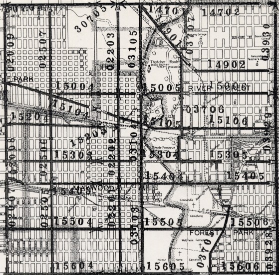
Proviso Township Map -- 1940s -- Eastern
Proviso
Township is located west of Chicago's Loop in west central Cook Country. The map to the right is Cook County. Proviso Township is "blackened".
We do not have an exact year noted for this map, but we have determined it is probably from the 1940s. This "guess" is based on the areas of holdings for the Cook Country Forest Preserve District and the Hines Hospital. Also the Congress Expressway is absent.
The first map includes sections 1 through 3 and 10 through 15.
The second map includes sections 22 through 27 and 34 through 36.
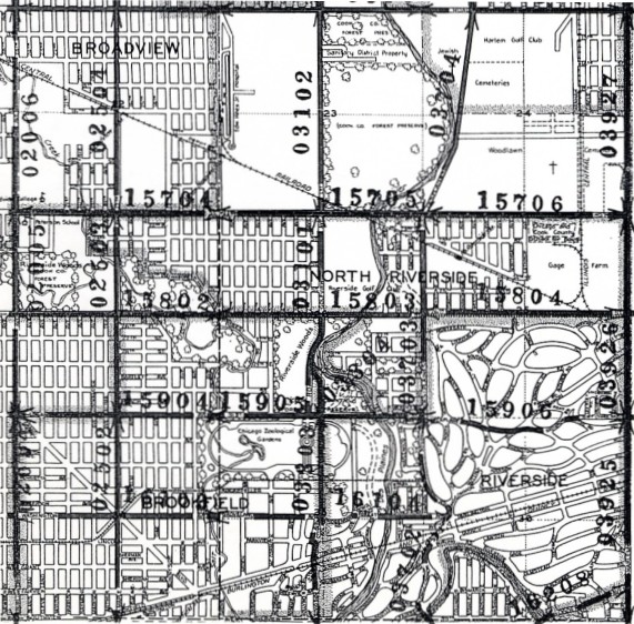
This map of Proviso Township is arranged in 36 sections, each approximately a square mile. The numbering of the township's sections is arranged like this:
| 6 | 5 | 4 | 3 | 2 | 1 |
| 7 | 8 | 9 | 10 | 11 | 12 |
| 18 | 17 | 16 | 15 | 14 | 13 |
| 19 | 20 | 21 | 22 | 23 | 24 |
| 30 | 29 | 28 | 27 | 26 | 25 |
| 31 | 32 | 33 | 34 | 35 | 36 |
To see the Township of York (immediately to the west of Proviso Township), click here.
Last Modified: 12/29/2002