www.FranzosenbuschHeritageProject.org Home
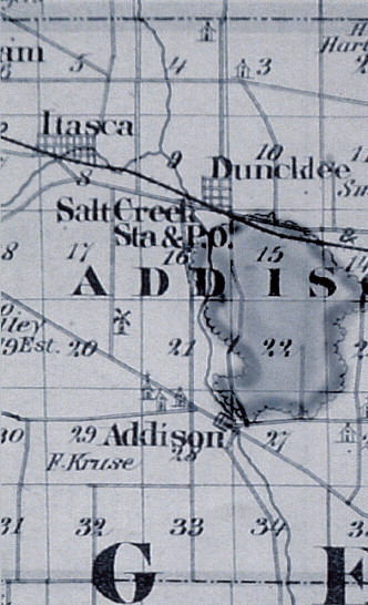
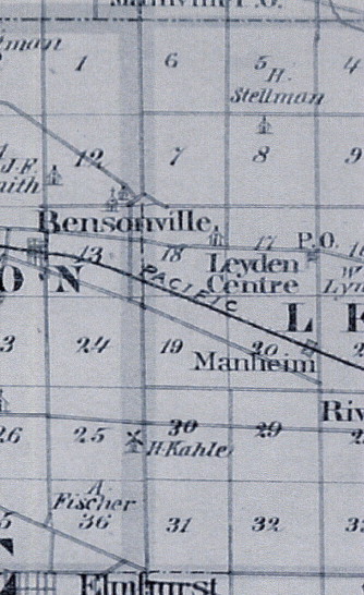
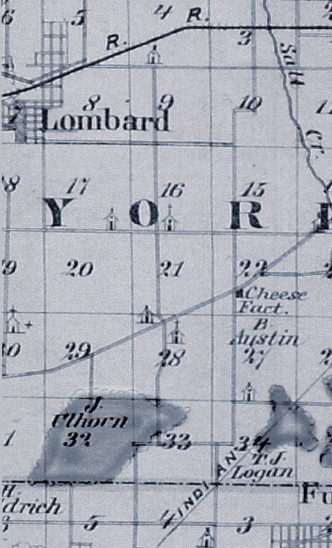
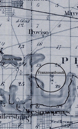
We present a section of the 1876 Illinois Atlas Map containing Addison, York and parts of Proviso and Leyden Townships. Franzosenbusch is in the lower right section. Zion Lutheran Church was in Churchville (which is near modern-day Bensonville), quite a walk for the Franzosenbusch school children before the opening of the "Southern School District" schoolhouse near the common corner of Proviso Township Sections 19, 20, 29 and 30. This corner is the current intersection of Wolf and Cermak (22nd Street) Roads.
The map has been "blocked" into four sections. Left-click on a section to see a larger view.
We welcome any comments, questions and corrections. In accumulating this information we have found conflicting evidence. We have endeavored to use the most reliable sources available BUT we can not be sure we have all of the facts completely accurate. We need your help. More information from the families of these nine "Founding Fathers" would be of great value to this ongoing project in order to maintain accuracy. At this time, we are especially interested in photos, journals, letters, etc., which would describe the southeast corner of 22nd Street (Cermak) and Wolf Road in Hillside, prior to the 1860's. This will help us now, as we work on the restoration.
Please feel free to contact me at j.arbuthnot@sbcglobal.net. I will route your email through our other researchers.
The primary compiler of this information was Lana Gits with:
Jim Arbuthnot
Larry Godson
Drew Reaves
Patricia Reaves
Shirley Slanker
Last Modified: 10/23/2002