 Proviso
Township is located west of Chicago's Loop in west central Cook Country.
Proviso
Township is located west of Chicago's Loop in west central Cook Country.www.FranzosenbuschHeritageProject.org Home
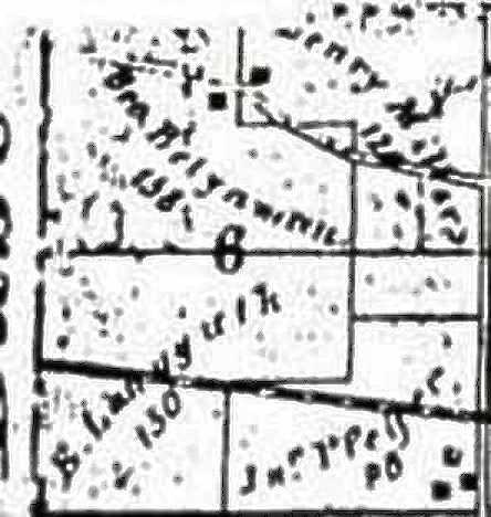
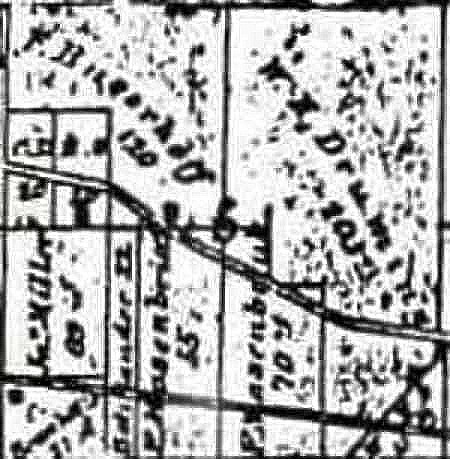
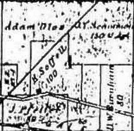
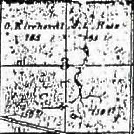
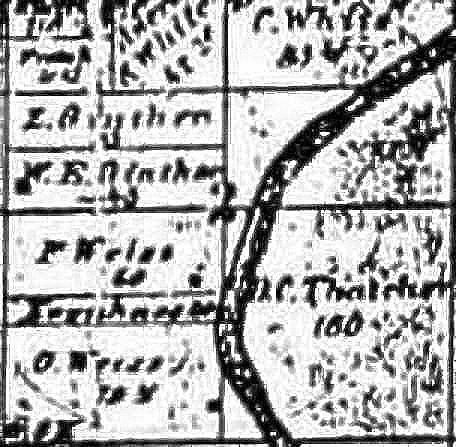
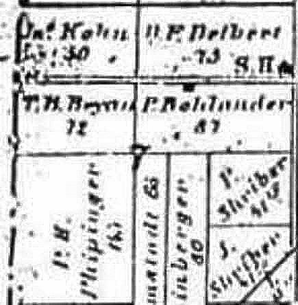
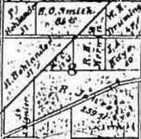
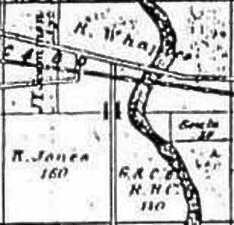
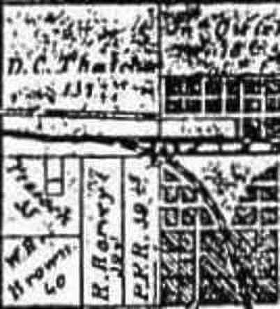
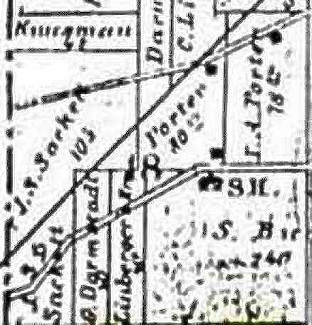
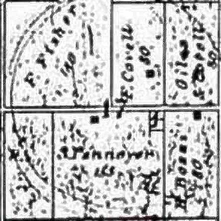
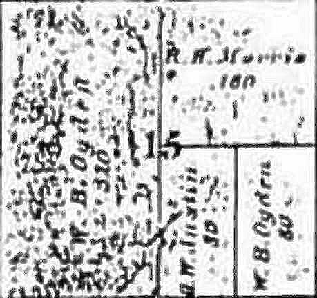
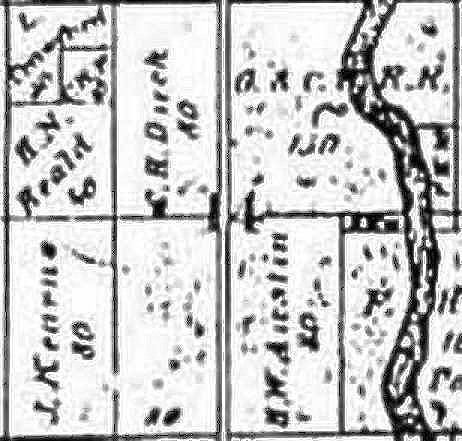
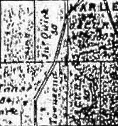
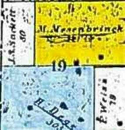
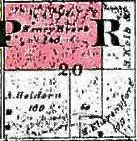
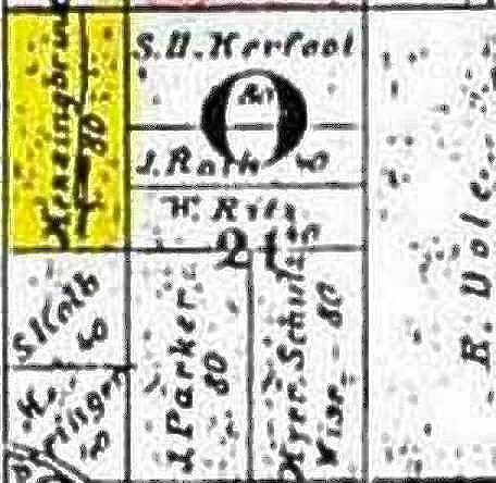
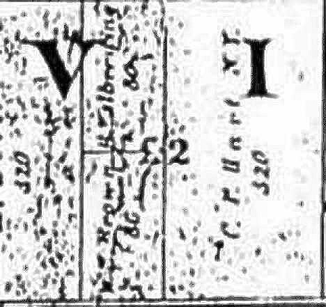
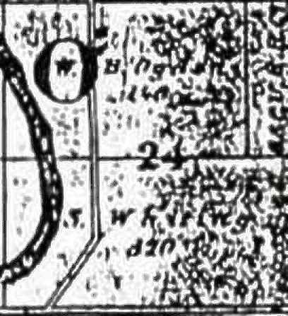
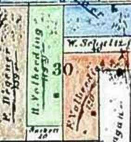
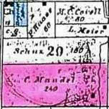
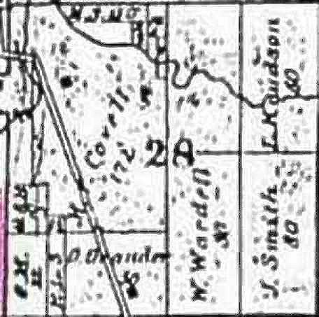
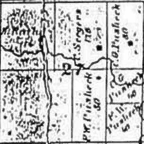
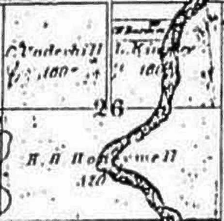
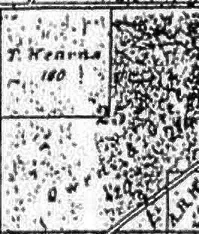
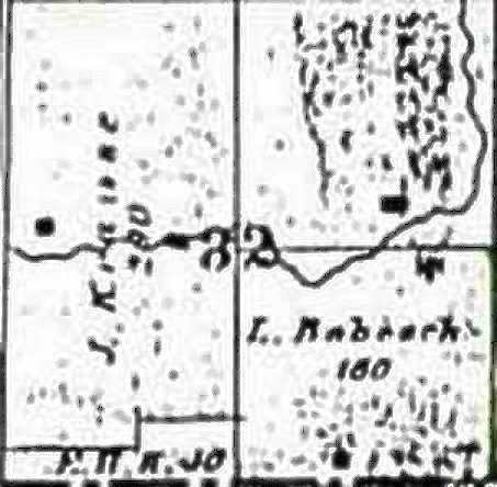
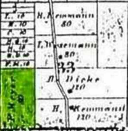
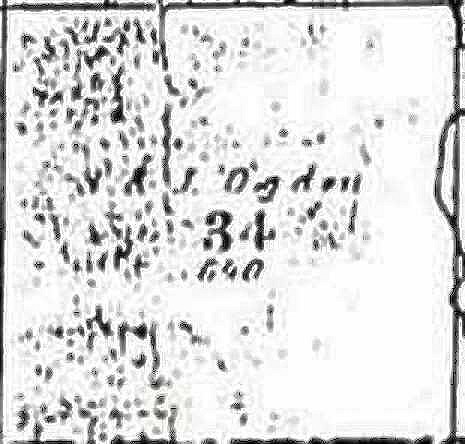
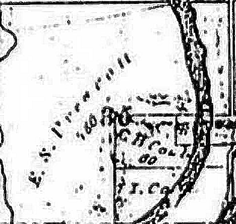
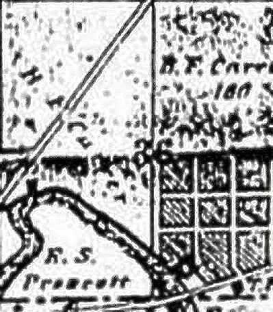
Land Ownership in 1863
Proviso
Township is located west of Chicago's Loop in west central Cook Country.
The map to the right is Cook County. Proviso Township is "blackened".
It should be noted that the term "township" has two meanings of which we are aware. All townships were originally laid out by surveyors. A survey township may be different than a political township. Though the years, some negotiating and swapping has resulted in portions of one surveyed township being POLITICALLY reassigned to an adjacent township.
The survey map of Proviso Township is arranged in 36 sections, each approximately a square mile. The numbering of the township's sections is arranged like this:
| 6 | 5 | 4 | 3 | 2 | 1 |
| 7 | 8 | 9 | 10 | 11 | 12 |
| 18 | 17 | 16 | 15 | 14 | 13 |
| 19 | 20 | 21 | 22 | 23 | 24 |
| 30 | 29 | 28 | 27 | 26 | 25 |
| 31 | 32 | 33 | 34 | 35 | 36 |
Click on a section below to get a larger view of that section. To give us some reference points:
Note: Best viewed with display resolution set to at least 1024 by 768. If your display has less resolution, the township sections may be inappropriately displayed on this screen.


It should be noted that the term "township" has two meanings of which we are aware. A survey township is different than a political township. Parts of three political townships are included on this survey township map.
To see the Township of York (immediately to the west of Proviso Township), click here.
For other background information see:
The primary source of this information is:
"Cobbs Directory - Pre 1900 Maps Springfield Historical Society", Proviso Township Library", 1898
Last Modified: 04/28/2003